

Top Things to See, Do, and Savor in France


Welcome to Paris, Giverny, and Normandy: A Guide through Romance, Art and History!
Paris: The city of love and lights and limitless charm. Stroll along the Seine, sip wine, indulge in pastries! So much to see and do in this romantic city – art, fashion, food, and flair. Parisians are known for their healthy and moderate eating habits. However, when visiting this city for a few days, it’s okay to indulge a little or A LOT.
Giverny: An enchanting village with the charming home and gardens of Claude Monet. Monet’s world famous water garden make you feel as if you are part of his beautiful impressionistic paintings!
Normandy Region: This region is full of deep emotion and dramatic landscapes. History is brought to life here with our remembrance of such great sacrifice and bravery.
France Basics:
Transportation Out of the Airport in Paris
Taxis
Beware! As you walk toward the taxi area at the CDG airport, many taxi-look-alikes will try to get your business. They are scammers. Look straight ahead. Go through to the roped off official area. An airport agent will be monitoring the line there. This official agent will show you to the next available taxi. ALWAYS ask for the fare approximation before you get inside as there are set fares inside the city.
Ride Sharing
Ubers are also available inside the city, but Lyft is not in Paris at this time (2025).
Train
Another transportation option is the train. The RER-B (blue line) train leaves right from the airport. It’s a great way to get a glimpse of the city as you make your way to your destination. Be pickpocket aware on the trains. Do not sit by the doors, make sure your bags are closed, and hold all your belongings.
Driving
A note about driving in France. There are 2 things which were significantly different versus driving in the US.
- Vehicles approaching from your right have the right of way. Even if you’re on what looks like the main road. It’s known as “priorité à droite” (priority to the right). If there are no signs indicating otherwise, then this is an understood rule. Sometimes there will be a sign with a white triangle. It will have a black cross (X-shaped intersection). This means cars from the right have priority.
- Motorcycles ride between the two lanes on the highways at very fast speeds. At one point, I moved to the left side of my lane while a tractor trailer was passing me on the right. This is where the motorcycles ride – in the same lane as me. If there had been a motorcycle riding the line on my left then I would have hit it.

Strikes
Strikes are commonplace in France. Do your homework, so you don’t get stuck, and you have alternatives. (I did not do my homework and was met with the “closed” sign above. I did have a Catacombs reservation that I had booked weeks beforehand. Fun fact: The official website was still taking reservations for that same day even though they were closed.
Transportation Strikes
The transportation companies typically announce transportation strikes ahead of time.
Worker Strikes
There are also worker strikes that affect tourist sites such as the Louvre and the Catacombs. I suggest googling “is there a strike at the ____ today” on the day of your reservation. Often, there is no notice even to ticket holders.
Money in France
France uses Euros. When traveling France in 2025, there was no need for cash for anything. Practically every place takes credit cards or Apple Pay.
Tipping in France
Tipping is not necessary but always welcomed and you do need Euros for that purpose only. I always get Euros from my bank in the US before traveling to Europe. This way, I avoid the outrageous fees at the airport. I also don’t have to wander around trying to find a bank.


Paris
Things to Do in Paris, France
Transportation Throughout Paris
The train system is easy to navigate to travel within Paris. You don’t need the Navigo app. Simply use Google Maps or Apple Maps. These apps give step-by-step instructions for walking, mass transportation options, or driving.
Options for purchasing tickets for the train include:
- Purchase a Navigo card at the kiosk in the train station. Buy as many one ways as needed.
- Get the Île de France app and purchase tickets ahead of time.
To use your ticket: Tap your physical ticket or ticket on your mobile phone to enter the turnstile. Tap out at the turnstile after exiting the train.
Other option: Uber/ridesharing
Paris Accommodations/Lodging
When it comes to accommodations, I personally love booking through VRBO. It gives me the chance to live like a local. But if you prefer hotels, Hotels.com has a great selection of hotels as well as apartments. Make sure to choose an area that’s centrally located so you can easily explore all that Paris has to offer.
I have stayed in the 6th and the 15th arrondissements and loved both areas.


Sainte-Chappelle
The Sainte-Chappelle is my most favorite place in Paris. It’s a breathtakingly beautiful 800 year old holy chapel. It has 1113 colorful stained-glass windows that depict scenes from the Old and New Testaments. Absolutely magnificent especially with the rays of the sunshine piercing through the glass!
Reservations, in advance, are recommended.


The Eiffel Tower
The Eiffel Tower was built in 1889 and was finished in just over 2 years! I’d recommend visiting at the pre-dusk time period. Beforehand, visit a local grocery store. (Use Google or Apple Maps app to find one.) Purchase wine, grapes, fancy cheeses, grapes, olives, prosciutto, chocolate and *baguettes*. Because, Paris.
Bring a blanket and your above provisions. Set up on the Champ du Mars (a large field on the south side of the Eiffel Tower). Wait for the sun to set. The tower lights up every hour, on the hour, and shines for 5 glorious minutes until 1:00 a.m. It’s a magical experience!
Be aware of pickpockets in this area. Just be smart about it, and you’ll be fine. Smart includes wearing a fanny pack UNDER your clothing. Keeping money and credit cards in separate areas of your person (e.g., front pockets, fanny packs). Never flash your money – just be discreet. And always be scanning the area. In other words, be alert and be obvious about it.

The Louvre, Paris
The symbol of the Louvre is the large glass and metal pyramid which serves as the main entrance. It is the world’s largest art museum and definitely worth the trip. Spend a few hours wandering through the galleries and admiring masterpieces. Reservations are highly recommended! Also note that the Louvre occasionally shuts down due to worker strikes.
Also, the original Mona Lisa lives in the Louvre. It’s usually a very long and slow line to glimpse her from a distance. I did visit with Mona Lisa at the same time as hundreds of other friends. I’m not so sure she was worth it.
Arc de Triomphe du Carrousel, Paris
After the museum, walk across the pavement to view the Arc de Triomphe du Carrousel. This monument commemorates Napoleon’s military victories. It is the little brother of the Arc de Triomphe de l’Étoile, and was built between 1806 and 1808.


Notre-Dame Cathedral of Paris
Notre Dame of Paris is an enormous Catholic cathedral dedicated to the Virgin Mary. It was built from 1163-1260. Interestingly, during the French Revolution much of it was destroyed. After the “Hunchback of Notre Dame” was written, the book led to a restoration of this magnificent cathedral.
Locals say that Notre-Dame’s interior is much brighter with the most recent renovation after the fire of 2019.
It is very highly recommended to get entry tickets online, ahead of time, 2 days beforehand as they sell out extremely fast. On the minute. Another option is to use Get Your Guide, but it is much more expensive.
Paris Catacombs
I had planned to tell you about the Catacombs. Unfortunately, they closed down for a “worker strike” on the day I had reservations. No notice.
The Catacombs is apparently a fascinating place. It holds the remains of over 6 million Parisians. These remains were exhumed from overcrowded cemeteries around Paris in the late 18th century. They were then relocated to abandoned limestone quarries under the city = the Catacombs.

Latin Quarter, Paris
Latin Quarter
This is my favorite area of Paris. It feels more authentic, inviting and less touristy. Even though there were crowds here in the summer.
The Latin Quarter has little cobblestone alleyways, winding side streets, squares and a cozy overall feel. A bonus: there are lots of bookstores! It’s best to just wander around this area and enjoy it.
Gardens and Squares, Paris
- Place de la Concorde was the site of 2,498 deaths by guillotine in the late 1700s. Notable figures executed there included Louis XVI and Marie Antoinette. It is now a public square with fountains and a large obelisk (monument).
- Jardin de Tuileries Park is bordered by the Seine and separates the Louvre Museum from the Place de la Concorde. Stroll through the to enjoy the blooms, statues, pools and activity.
- Le Jardin du Luxembourg is a large, free park, in the 6th arrondissement, with gardens, statues, and a fountain. There is also an apiary, forest, and pond in this park.


Montmartre, Paris
Montmartre is a village-like section of Paris atop a hill which overlooks the city. This area is known for inspiring artists, painters, writers and musicians. It’s easy to reach by train and is known for its many steps to reach the top. At the top, you’ll find the awe inspiring Sacré-Coeur Basilica, as its crown jewel, as well as a maze of restaurants and local shops.
Honestly, I didn’t see too much here except for the funicular and the basilica. It was crazy crowded on a Saturday in June. Difficult to even see the sites. I’m sure it’s better in other seasons.
Electric Bikes and Scooters
Electric bikes are a fun and quick way to get around the city. Electric scooters are also great for just cruising a few blocks or more. They are parked on many city streets and require an app to use them.


Bike Tour of Paris
Another adventure day includes a bike tour of the city! You get to be outdoors, have fun, experience an enthusiastic tour guide, and learn all about the history of Paris! The 3 hour “Parisian Day Tour” by Bike About Tours is recommended. Plus you’ll get to meet other tourists and learn which sites they have loved.


Eating in Paris
Food – try everything! You will find many cute bakeries, cafés, and restaurants. They offer fresh French bread, pastries, and buttery croissants. You can enjoy crêpes, Boeuf Bourguignon (beef stew), and Coq au Vin (chicken stew). Don’t miss the Jambon-Beurre sandwich (baguette with butter and ham) and the delicious sauces (jus).
Places to See Outside of Paris:


Versailles
Less than 18 miles to the west of Paris is the lovely village of Versailles. Mostly known for the Château de Versailles palace from the 17th century and its immaculate gardens.
If you are going to the palace, I *strongly* recommend purchasing tickets ahead of time. I was there in August and waited 3+ hours outdoors in long, winding lines to get in. Low on the fun meter.
Once inside the Hall of Mirrors, bedrooms and architecture were interesting and a sight to see. The gardens are grandiose (including fountains and sculptures) and its fun to imagine living there with such decadence.
I recommend getting to Versailles early in the day or staying after your palace visit to explore this quaint town. There are outdoor restaurants with seating practically on the street, the Versailles cathedral, cobblestone streets and more. It’s absolutely lovely!
To get to Versailles, taking the RER train is the least expensive option and takes about an hour. Find the closest metro station and buy a ticket (machines/kiosks have an English option) to “Versailles Château Rive Gauche” station. You may need to take a combo of the métro (the sign is a blue “M” with a circle around it) and RER C line. When you arrive in Versailles, it’s a quick 13 minute walk to the palace.


Giverny
Things to Do in Giverny, France
Giverny is absolutely lovely! What a surprise it was to encounter this little gem! The town is quiet and quaint. It is walkable with many places to eat and drink alongside gardens and cobblestone roadways. There are also a few shops selling tourist must-haves.
Monet’s Home and Gardens
The most amazing area was Monet’s home and his magnificent gardens! The streams, pond, and pathways are surrounded by blooming flowers, bushes and trees of every color, shape and size. It’s astoundingly beautiful and peaceful and difficult to leave! Not to mention the waterlilies in the pond by Monet’s wooden boats! To be honest, this is my favorite location in all of France (so far).
Inside of Monet’s house is also a delight with whimsical paint and decor! The tour takes you through the kitchen, bedrooms, office/living area, and bathroom.
Use this link to get reservations – it is official. The Maison et jardins de Claude Monet website no longer works.
Normandy Region
Things to Do in Normandy, France


D-Day Tour, Normandy Region
As an American, I wanted to visit areas where the brave Americans came ashore on that fateful D-Day. I used Get Your Guide for the tour of Omaha Beach, the American cemetery and Pointe Du Hoc. At each location, we learned about the occurrences involving our troops. It’s so important to remember our allies and all the amazing heroic men of those countries as well. So much sacrifice for us. I’m forever thankful for all of those incredible humans.


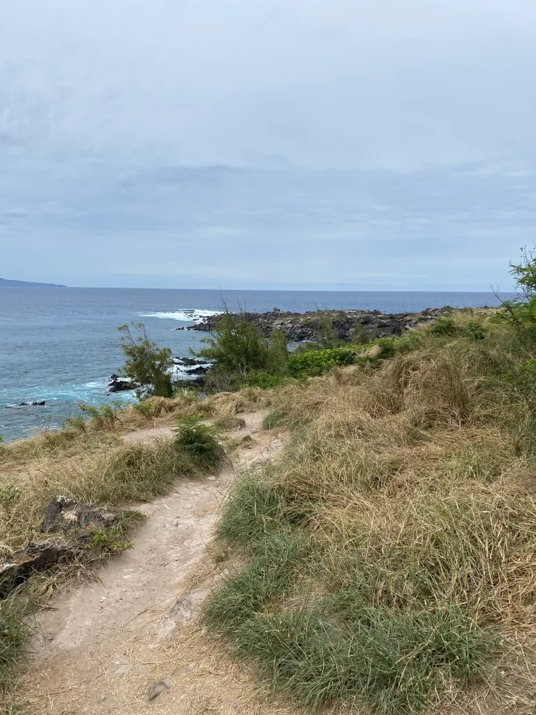
Port-En-Bessin, Normandy Region
To access the many historical sites and beauty of the region, Port-En-Bessin is a wonderful option for accommodations/lodging. It’s a little fishing village on the coast, nestled between cliffs and the beaches of Omaha and Gold. Check VRBO. I found an amazing place right on the water that was walkable to dining and shops.


Bayeux, Normandy Region
Bayeux is a historical area that’s a moderately-sized city with sidewalk cafes and shops. Bayeux was the first major town in Normandy to be liberated by the Allies on June 7, 1944, just after D-Day. Therefore, it was spared from destruction during WWII.
This city’s 13th century Notre Dame (of Bayeux) feels as large as Paris’ Notre Dame, but it is incredibly less crowded. I enjoyed it more than the Paris one, to be honest. Plus it’s free with no reservations needed. Many areas of this church are accessible to the public including the underground crypt!


Caen Memorial Museum, Normandy Region
The D-Day Museum in Caen is highly recommended and focuses on D-Day and WWII. It is very well done, large and educational and even has at least 2 enigma machines (as seen in the “Imitation Game” movie). It’s so important to know our collective history as not to make the mistakes of the past. Leave several hours to see this remarkable museum.


Mont Saint-Michel, Normandy Region
This former abbey, fortress and prison is a sight to behold! It can be seen from miles away and only gets more shockingly stunning as you approach it. Honestly, the enormity of it, once inside, was also surprising to me! There are cobblestone alleyways, leading upwards, with an abundance of shops and eateries and even a post office. A medieval village! Even a hotel inside. There are outdoor areas to explore with a cemetery (some recent guests), outdoor decks and viewpoints. This is before even paying to tour the actual abbey at the top.
Once inside the 11th century abbey, there is a new discovery around each corner. You will find tucked away sanctuaries, chapels, altars, crypts, giant archways, and rose gardens, etc. So many nooks and crannies and all of it fabulous!
Leave a big chunk of time to explore this very large Mont Saint-Michel! No reservations needed.
Getting to Mont Saint-Michel
The parking lot for this abbey is 1.5 miles from the actual abbey. I am almost always a walker; however, I am thankful for the shuttle (‘Le Passeur‘) in this instance. The free shuttle will take you from the end of the parking area to the bridge in front of the abbey. As opposed to the 1.5+ mile walk in a sun-exposed area along the road. Also know that once you are in the abbey, you will be walking and climbing many stairs for hours. The shuttle is the way to go.
Suggested Paris/Giverny/Normandy quicktripadventure Itinerary:


My helpful links to book your travel here


